Weekly Reports from Jordan
Choose Year: or Choose week
Archaeological Impressions: Week 5
Kent V. Bramlett, Chief Archaeologist

This week (and the first two days of the next, our final days of excavation) has been a flurry of activity, toil, excitement, and a push to clear the layers that will achieve our goals for the season. It has been a much focused expedition, with each field working toward answering specific questions. Do we have the answers? Finally, yes.
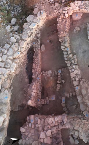
 In Field A, we now comprehend two phases in House D of the Early Iron I community, along the western edge of the acropolis. The challenge of the last few days for the Field A team involved accurately tracing the compacted-earth, second-phase floor. This was the floor in existence when the house and neighboring houses were burned in a hostile encounter, evidenced by scattered weapon points and human casualties. And it was a difficult floor to trace because of the lack of plastering in most places. However, the indicative flat-lying pottery sherds and discarded animal bone fragments typically trampled into domestic floors showed where careful excavation paid off. Most of the subdividing walls in the eastern part of the building are founded at this second-phase level. That is, they are built over the material upon which this floor was constructed.
 And that brings us to an interesting point. The deep destruction of burned mud-bricks and charred beams buried all the area of this house. But beneath the second-phase floor was an original floor which we uncovered in part of the building in 2010, and which this week we could see in several sub-balks sectioning the second-phase floor. The original floor was a nicely constructed plaster floor with an even richer assortment of broken pottery. But over this floor, and between it and the second-phase floor, was a varying layer of mud-brick debris. However, this mud-brick was not burned. One could still see the voids from the decayed organic matter added to make the bricks, but the detritus had re-compacted into an amorphous mass of clay and other brick ingredients.
Our interpretation of the evidence suggests an earthquake damaged the LB/Early Iron I settlement during its first phase in around 1200 BC, causing a collapse of upper-story mud-brick walls and particular damage to the walls along the west lip of the tell due to the collapse of the bedrock under the old Middle Bronze Age rampart to the west. What is telling, is that repair for the second phase of use for the buildings dug out more of the collapsed debris in the western extent of Building D and also Building C, thus accounting for little distinction between the two phases of floor along the western perimeter wall, but a greater depth of earthquake debris was left farther from the rampart edge, so a greater distinction between floors was evident as one progressed eastward. Heavy rebuilding along the western lip of the tell following the earthquake accords with an evident repair in the common wall between Houses D and C at the point where the distinction between the two floors becomes negligible and indicates complete clearing and rebuilding by the village inhabitants.
We can now suggest an origin for the ‘Umayri Stratum 13 fills found in the repair of the earthquake breach and rampart heightening of the Phase 12 construction project. No doubt, the villagers excavated out much of their houses (second-story mudbrick collapse) along the western slope as they rebuilt them and used the debris in the refortification effort, digging out less material farther east in their houses. This begins to answer a long-standing question about the phasing of the transitional LB/Early Iron I settlement in relationship to the earthquake and fiery destruction.
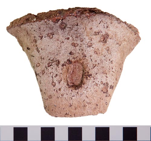
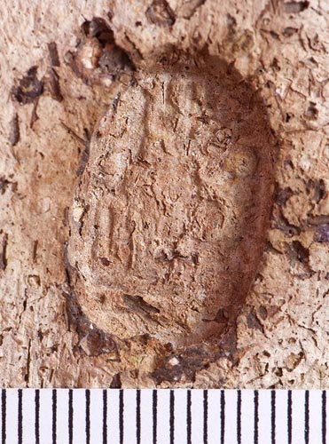
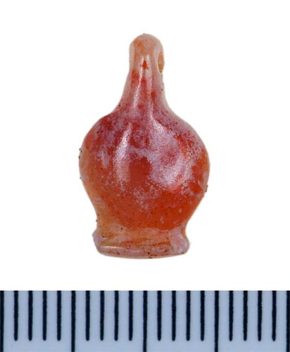 If that wasn’t enough excitement for Field A, several objects recovered provided “small finds” to round out the larger architectural phasing discoveries. Audrey uncovered a large lamp and Sashiere found a carnelian lotus pendent while sifting. In 2010, a similar pendent was found in Field H, though it was broken along one edge. This one is complete and provides another example of the popularity of Egyptianized status symbols around the turn of the 12th century BC in the southern Levant. Field A people found two more jar handles impressed with scarab seal impressions. Both are more worn than last week’s Thutmose III exemplar, but one may indeed be another of the same. These indubitably came from the context of House D and its neighbors, so we have stronger reasons for placing the other two firmly in the Stratum 12 context.
|
|
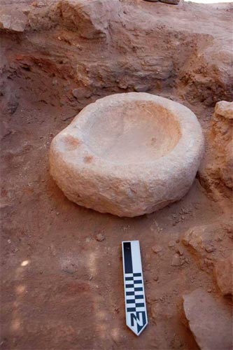
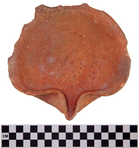
 Over in Field H, Matthew “Hew” Murdoch caused a flurry of excitement when in his and Jillian’s probe, he found a stone basin under the floor of the Iron IA house (House M). It looks to be a pressing basin of some sort and on one side the rim has a small depression with a channel draining back into the basin, presumably for holding a small dipper juglet. Perhaps this vessel was used at a household level for pressing olives and skimming off the oil (and not as illustrated here). Carrying it off the tell presented a logistical challenge. Meanwhile, Nikki and Robyn finished excavating a deep probe in the north-east corner of the building and began another one along the western extension where the perimeter wall runs.
|
|
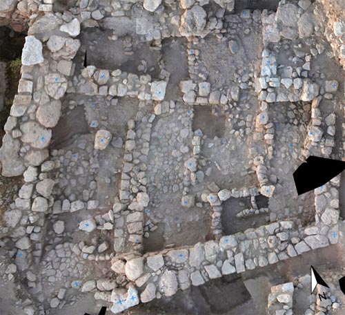
These probes (a total of four) have told us much about the sequence of construction in this area. Already last week we knew that the Iron IA house was built as a unit and that its outer walls did not represent an earlier construction phase. Deeper excavation in the probes confirmed the date of the burned brick layer under the house. The ceramics retrieved from that fiery destruction layer place it in the LB/Early Iron I transitional period confirming our identification last week with the fiery destruction of the buildings to the north. Moreover, excavation revealed a wall running east-west from the first probe and was picked up further west in another probe. That, combined with a wall line exposed in the south-west probe, begins to allow us to plot out architecture from the transitional village in Field H. Additionally, surfaces and one-course wall lines indicate a building phase built over the transitional rubble, but preceding House M. The ceramics are identical to those found in House M, so we hypothesize it may represent an initial Iron IA structure that was expanded into the larger building.

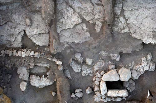
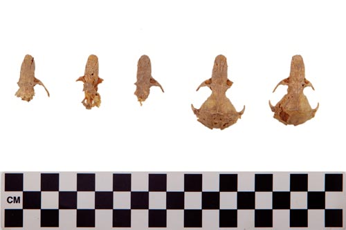 Field L continued to work at extracting the two in situ pithoi. This entailed the declaration and recording of several more loci: the installation pits dug for each, the fill between pots and pit walls, two layers of debris in each vessel, earth covering the original exposure surface. The earth from the bottoms of the two vessels was saved for “floatation,” a process which can retrieve minute artifacts and organic matter. But in the process of clearing the northern pithos, five rat skulls were found, perished in the meter deep interior of the store jar. This provides vivid illustration of the age-old contest between farmer and vermin for the fruits of human labor. And the contest was indeed for life and death, starvation or sustenance; and ironically, in the case of the five rats, abundance became death.
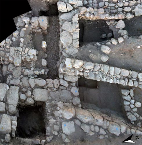
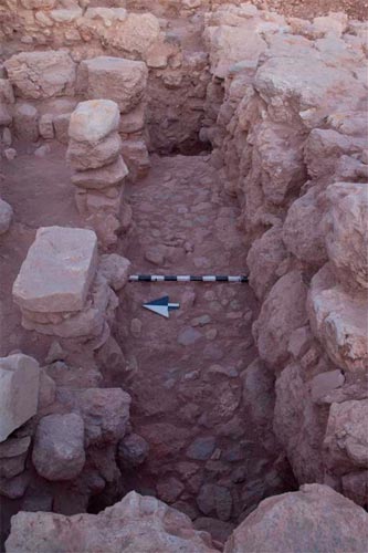 The week-long work documenting and carefully excavating the pithoi delayed the deepening of the probe in Erin’s square. The probe had been intended to illuminate the depth, date, and perhaps, function of the megalithic walls juncturing where the pithoi were found. But with the tireless persistence of adjacent square supervisor, Kevin Burrell, two other probes investigated the possible Iron I wall running east-west across the field. Both of these probes, but especially on the north side of the wall in conjunction with Mary Boyd’s work, succeeded in demonstrating that the wall was Iron II (Iron IIB to late Iron II). Only the lowest course, offset and used as a foundation course for the later wall, dated to the Iron I. The superstructure of the wall and a nice cobble surface formed a pillared room where excavated. This structure was modified in the Persian period and a door blocked to make the basement cellar where the two pithoi were installed.
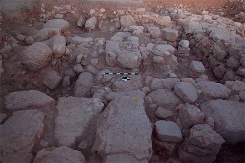 And finally, during the last two days of excavation this season, Erin, Leon, and Deirdre solved the quest for answers to the megalithic stones of Field L. They date to the Iron IIB (or slightly later). Indeed, their founding level is contemporary with the cobbled room. We don’t know yet the function of the complete structure, but it is intriguing. The only comparably-sized stones are in a buttress tower of the western defense wall dating to the Iron IIB. The late 9th and 8th centuries BC represented a period of “polity formation” in the region of the Ammonites, as well as for Israel, Judah, and Moab. This is when many of the signature structures indicative of a state-like entity were first built. Think of Omri’s capital at Samaria, Mesha and his claims in the Moabite Stone, and in the 8th century, the importance of defensive fortifications as Assyria became a threat from the north. So it seems probable that we have a structure of defensive or administrative importance coming to light in Field L. One intriguing possibility sees gate-like piers in the layout of the large walls, with a possible passage way three meters wide. But there is not enough of the walls yet revealed to validate this identification. We await next season!
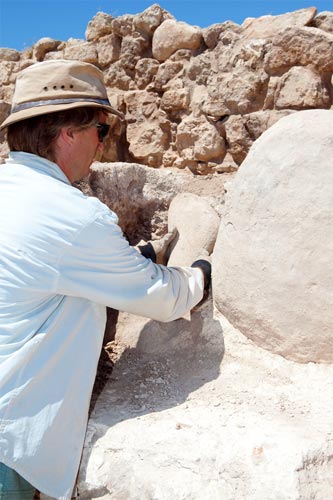
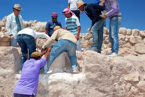
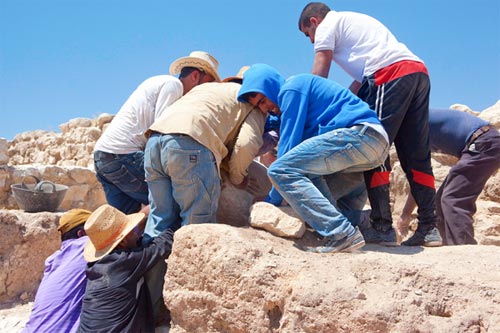
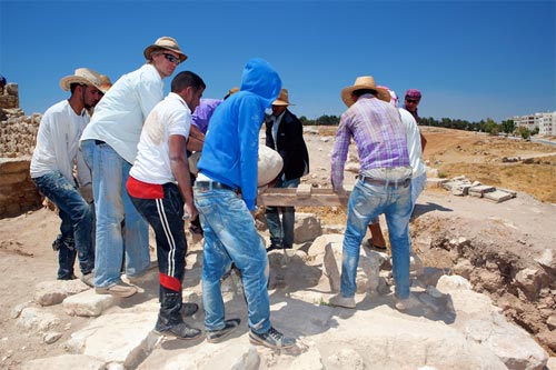
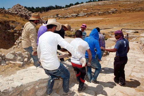
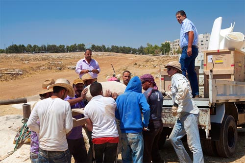
With the LiDAR scanning of Field B, we now felt it was time to remove the standing stones from the Late Bronze Age sanctuary. It was a sad but necessary move. We could no longer feel confident in their security there and we now have plans to reconstruct the cult niche at the Amman Citadel Museum. This will ensure their preservation and visibility for generations to come.
 |
 |
 |
 |
 |
 |
 |
 |
 |
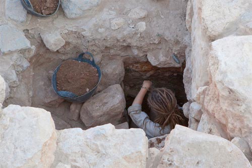
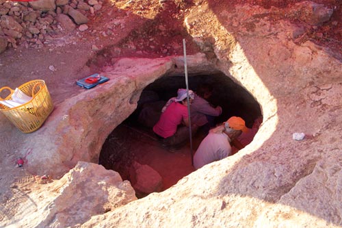 Over at Site 84, David and Amanda succeeded in cutting a section deep into the cave’s fill. Traces of plaster-cement were found in the cave suggesting it may have functioned as a cistern at one time. But another season will be necessary to fully establish whether or not it served as a cellar for wine production contemporary to the 6th-century farmstead.
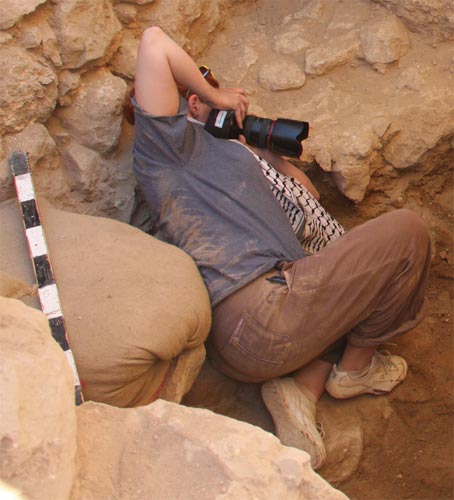
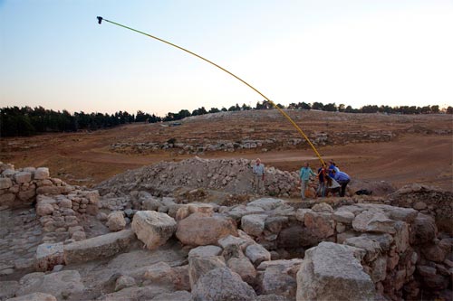
Final photos for all fields except Site 84 were taken with the photo boom system, resulting in a stitched composite for each area.
 |
 |
 |
 |
 |
 |
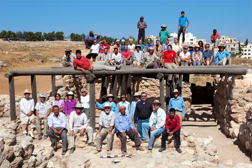 Thus ends an exceptionally productive and rewarding season of excavation, which provided answers to all the major questions we brought into the field. Our sincere gratitude to the entire team and supporters everywhere.